Malyovitsa Travel Guide: Hiking the Rila Mountains
Plan your Malyovitsa hike with route options, elevation stats, trailhead directions, packing tips, and timing advice for the Rila Mountains in 2026.
On this page
Malyovitsa: Complete Rila Mountains Hiking Guide
Malyovitsa is a 2,729-meter peak in the Rila Mountains, one of Bulgaria's most recognized hiking destinations. The area combines a dramatic summit climb with the turquoise Scary Lake circuit, both reachable on a long day trip from Sofia. This guide covers the main attractions, trailhead logistics, elevation profile, and planning tips travelers need before booking a trip.
Total transfer time from Sofia runs about three hours each way, so an early start matters. Expect route options ranging from a 12-kilometer lake circuit to a 14-kilometer summit push, each with different elevation gain. Read on for the specifics that help decide which route, season, and support level fits best.
Must-See Malyovitsa Attractions
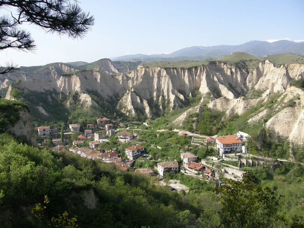
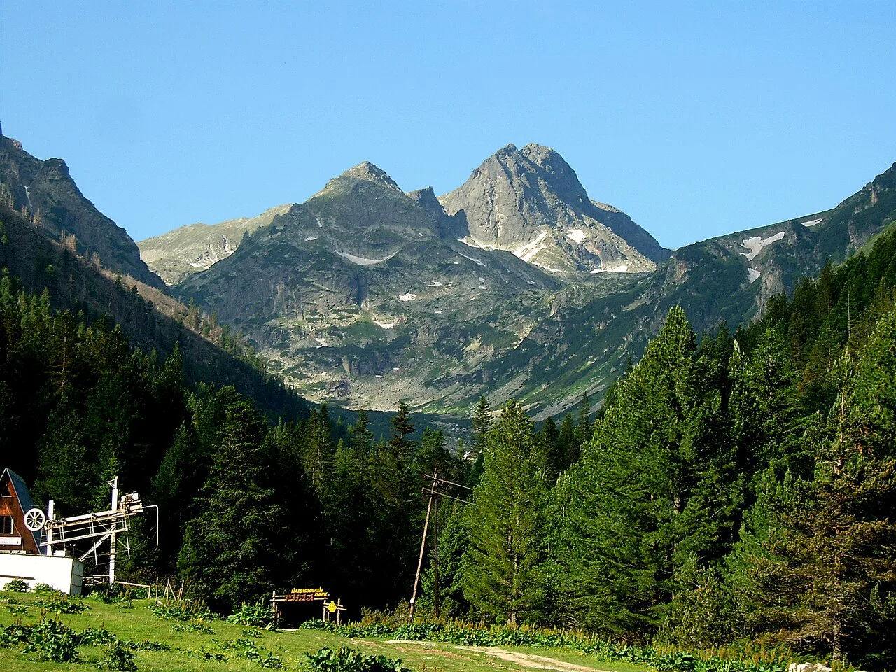
Malyovitsa Peak rises 2,729 meters above sea level in the northwestern Rila Mountains. The summit trail passes a memorial tablet honoring Bulgarian climbers who died on expeditions at home and abroad. On clear days, the view extends toward Rila Monastery, a UNESCO World Heritage site in the valley below.
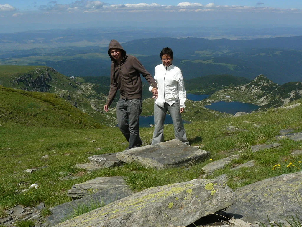
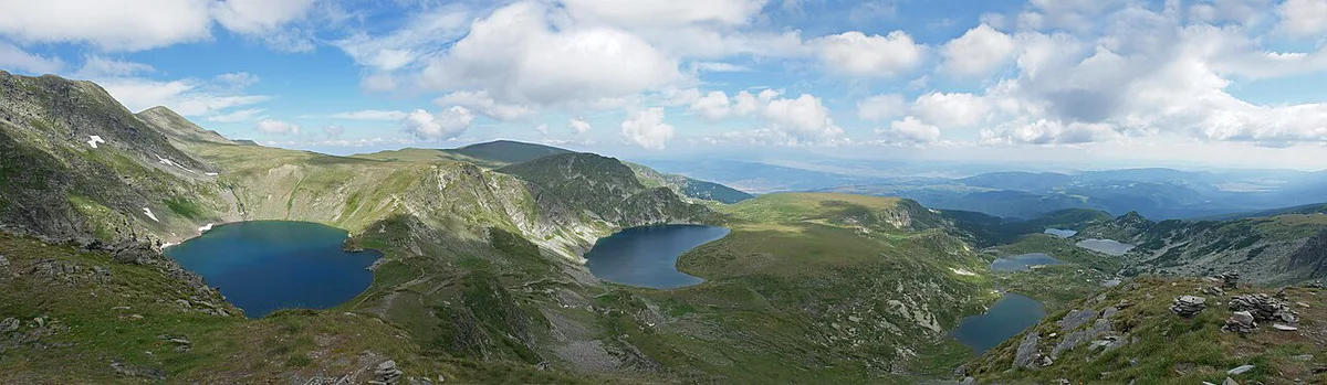
The Scary Lake sits above the tree line on the alternate circuit route. Local legend says a storm-caught hiker named it after answering only 'the Scary Lake' when asked where he came from. A small shelter now stands on its shore, giving hikers cover during sudden mountain storms.
Yonchevo Lake sits lower on the circuit, reached after the descent from Scary Lake. Both lakes and the summit route start from the same trailhead near Malyovitsa Resort.
- Malyovitsa Peak (2,729m)
- Elevation: 2,729 meters
- Terrain: rocky, above tree line
- View: Rila Monastery visible
- Trail: out-and-back summit route
- The Scary Lake
- Type: turquoise alpine lake
- Shelter: small emergency hut onsite
- Route: part of 12km circuit
- Yonchevo Lake
- Position: lower elevation stop
- Access: descent leg of circuit
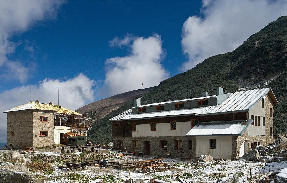
- Malyovitsa Hut
- Role: mid-route rest stop
- Food: soups, grilled meat, tea
- Note: split point for both routes
Museums, Art, and Culture in Malyovitsa
Malyovitsa carries deep meaning for Bulgarian mountaineering rather than traditional museums or galleries. The memorial tablet near the summit route honors climbers who died in expeditions across Bulgaria and abroad. Many hikers pause there to read the names before continuing toward the peak.
Malyovitsa Hut anchors this heritage as a meeting point for generations of climbers and mountain leaders. The hut earned recognition as Malyovitsa Hut Awarded Best Tourist Hut Of 2016 for its role in Bulgarian hiking culture. That legacy still shapes how the trail and hut welcome hikers each season.
From the summit, hikers can see Rila Monastery, a UNESCO-listed complex in the valley below. The monastery is not part of this hike but adds cultural context to the wider Rila Mountains.
Parks, Gardens, and Outdoor Spots in Malyovitsa
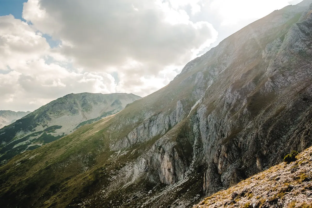
Malyovitsa sits inside Rila National Park, Bulgaria's largest protected mountain area. The trail begins in dense forest along the Malyovishka River before climbing into open alpine terrain. Sheer cliffs frame much of the upper valley, giving the hike a dramatic, exposed feel.
Above Malyovitsa Hut, the landscape turns to rocky terrain with little tree cover. This section exposes hikers directly to wind and weather changes typical of high Rila peaks. Check the Rila National Park Travel Guide 2026 for wider trail options across the park.
Wildflowers and alpine grasses cover the lower slopes during summer months. Weather in this zone shifts quickly, so pack layers even on a clear morning.
Family-Friendly and Budget-Friendly Options in Malyovitsa
Malyovitsa suits experienced hikers more than young families, given the steep, rocky terrain. Both routes require sturdy hiking boots and reasonable fitness, not flip-flops or casual footwear. Budget-focused travelers can choose a self-guided option instead of a guided tour.
Guided tours typically include transfer from Sofia, an English-speaking guide, and route support. Self-guided bookings include detailed English route notes and maps instead of a guide. Neither option includes meals or tips, so budget separately for food along the trail.
Group sizes for guided tours usually stay small, often between two and six hikers. Organizers cap most groups at twelve people, even when several bookings combine.
How to Plan a Smooth Malyovitsa Attractions Day
A smooth Malyovitsa day starts with an early pickup from Sofia accommodation. Total transfer time runs about three hours each way between Sofia and the trailhead. That leaves most of the day for the actual hike itself.
Mountain weather changes rapidly between the hut and ridge, even when starting clear. Afternoon thunderstorms are common in summer. Start early; turn back if visibility closes or dark clouds form over the upper valley.
Plan for roughly eight hours of hiking on the summit route. Including transfers, the full day usually runs eleven to twelve hours from start to finish. Build in buffer time for lunch stops and photo breaks at the lakes or summit.
Review the full 10 Best Bulgaria Hiking Trails to Try in 2026 before locking in a date. It helps compare Malyovitsa against other Rila and Pirin routes for timing and difficulty.
Getting to the Malyovitsa Mountain Trailhead
Both routes start at the Central Mountain School of Malyovitsa, near Malyovitsa Resort. Organized transfers from Sofia cover this leg directly, with a total transfer time near three hours. That figure covers pickup, the drive to the resort, and the return trip after the hike.
Travelers with their own car can drive to Malyovitsa Resort and park near the trailhead. Self-drive saves the transfer cost but skips the route notes included with self-guided bookings. Weigh the extra planning time against the savings before deciding which option fits better.
Arrive early, since both trailhead options assume a full day on the mountain. A late start risks finishing the descent after daylight fades in shoulder-season months.
Insider Hints for Malyovitsa Mountain
Pack a 15 to 35 liter rucksack, since day packs work fine for this route. Bring a waterproof jacket and a fleece layer, even if the forecast looks clear at the start. Mountain weather in the Rila range shifts fast, especially above the tree line.
Pack a 15–35L rucksack with sturdy hiking shoes, waterproof jacket, fleece layer, headlamp, and packed lunch. Food options are limited to the hut and resort, with only soups, grilled meat, salads, and tea available.
Sturdy hiking shoes are essential on the rocky upper sections near the summit. Add sunglasses, sun cream, a hat, and hiking poles for the steep, loose-rock stretches. Carry a headlamp and a packed lunch, since food options are limited before the hut.
Basic meals at Malyovitsa Hut and the resort cover soups, grilled meat, salads, and tea. Plan snacks anyway, since time on the trail limits long stops for food.
Malyovitsa Mountain Elevation Graph
The summit route gains about 1,040 meters over roughly seven kilometers to the top. The Scary Lake circuit gains a gentler 880 meters over its 12-kilometer loop. Both routes share the same lower section before splitting at Malyovitsa Hut.
From the hut, reaching the first rest point usually takes about 30 minutes. Hikers then cross two rocky plateaus, often called the first and second terrace. Each of these terrace stretches takes roughly 45 minutes at a steady pace.
The final push from the second terrace to the summit takes about 3.5 hours. Descent follows the same path and usually takes about 2.5 hours back to the hut.
- Trailhead to Malyovitsa Hut
- Terrain: forest, then open valley
- Pace: moderate, well-marked path
- Hut to first rest point
- Time: about 30 minutes
- Terrain: rocky, above tree line
- First and second terrace
- Time: about 45 minutes each
- Terrain: rocky plateaus
- Second terrace to summit
- Time: about 3.5 hours
- Note: steepest section
- Summit descent to hut
- Time: about 2.5 hours
- Route: same path as ascent
Route Description for Malyovitsa Mountain
The Scary Lake circuit runs about 12 kilometers and takes roughly five and a half hours without breaks. It climbs through forest, crosses the Malyovishka River, then opens onto rocky ground near the lake. The route then descends past Yonchevo Lake before looping back to the resort.
The summit route covers about 14 kilometers, splitting from the lake path at Malyovitsa Hut. It climbs past the memorial tablet, over two rocky terraces, onto the exposed final ridge. Both routes rate as arduous, better suited to fit or experienced hikers than casual walkers.
| Route | Distance | Elevation Gain | Time Required | Difficulty |
|---|---|---|---|---|
| Scary Lake Circuit | 12 km | 880 meters | 5.5 hours | Arduous, better suited to experienced hikers |
| Summit Route | 14 km | 1,040 meters | 8 hours | Arduous, requires strong fitness and mountaineering experience |
Most of the trail runs above the tree line on exposed, rocky ground. Expect occasional steep stretches, so waterproof and windproof layers matter on both routes.
Find more hiking trips
Malyovitsa pairs well with other Rila Mountains routes for travelers planning a longer Bulgaria trip. The Vihren Peak Travel Guide: Trail, Tips & Season covers a comparable high-altitude route in the nearby Pirin Mountains. Comparing both helps decide which peak fits available time and fitness level better.
For broader trip planning, browse the Tours Bulgaria travel blog for more mountain guides. It covers route comparisons, seasonal advice, and other Rila and Pirin destinations worth adding.
Trip photos and route discussions from past hikers also circulate on social platforms like Tumblr. These informal shares offer a candid look at trail conditions between official updates.
Similar posts appear on Google+, adding another angle on the trail experience. Treat these as supplementary color alongside official route notes rather than a replacement for them.
Weather and Season Conditions on Malyovitsa
Malyovitsa’s weather should be checked as a mountain forecast, not just as a Sofia or Samokov forecast. The route climbs from Malyovitsa Resort through forest to Malyovitsa Hut, then spends long stretches above the tree line on rocky terraces below the 2,729-meter summit. Wind, cloud, and temperature can change sharply between the hut and the final ridge, even when the valley starts clear.
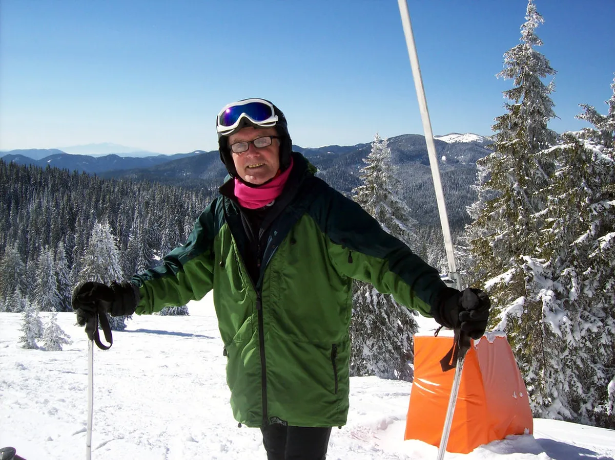
Summer is the most practical season for most visitors, but afternoon thunderstorms are common in the Rila Mountains, so start early and treat dark cloud over the upper valley as a serious warning. In late autumn, winter, and early spring, snow and ice can cover the terraces and ridge; the summit route then becomes a mountaineering objective rather than a regular hiking day. If visibility closes in, the safer decision is usually to turn around at Malyovitsa Hut or the lower terraces instead of pushing toward the summit.
Frequently Asked Questions
How long does the Malyovitsa hike take?
The summit route takes about 8 hours of hiking, and the full day trip from Sofia usually runs 11 to 12 hours. The Scary Lake circuit takes closer to 5.5 hours without breaks. Add transfer time of about three hours each way when planning departure and return.
Which Malyovitsa options fit first-time visitors?
First-time visitors without high-altitude experience often do better on the Scary Lake circuit, which gains 880 meters over 12 kilometers. The summit route gains 1,040 meters and demands stronger fitness and prior mountaineering experience. Guided options add route support for hikers new to the Rila Mountains.
What should travelers avoid when planning a Malyovitsa trip?
Avoid flip-flops, sandals, or casual sneakers, since most of the trail runs over exposed, rocky ground. Skip a late start, since the summit route alone needs about 8 hours of hiking time. Don't rely only on trailside food, since options are limited to Malyovitsa Hut and the resort.
Is Malyovitsa worth including on a short Bulgaria itinerary?
Malyovitsa fits well into a short itinerary since it runs as a single long day trip from Sofia. Fit hikers reach a summit view toward Rila Monastery without needing multiple travel days. Confirm current transfer schedules before booking, since timing anchors the rest of the day.
Malyovitsa rewards hikers with a genuine high-mountain experience just hours from Sofia. Whether choosing the Scary Lake circuit or the summit push, expect a full, demanding day outdoors. Confirm season, gear, and transfer times before booking either route.
Pair the trip with wider Rila Mountains planning for a fuller Bulgaria hiking itinerary. Compare nearby peaks and trip resources before settling on a final Malyovitsa route.
Continue reading
More guides you'll find useful