Bansko Ski Map: Complete Piste & Lift Guide
Last updated July 2026, this Bansko ski map guide breaks the resort down into its three real sectors, 16 lifts, and roughly 48km of marked piste, so you can plan a route before ever joining the queue for the gondola. Whether you are working out the easiest way down from Banderishka Polyana or tracing how the long valley run drops toward Shiligarnika, the notes below cover what a static map alone will not: lift bottlenecks, closing times, and where the terrain runs harder than its colour coding suggests. Read it alongside the resort's official piste map to match current conditions to the right sector for the 2026/27 season.
Bansko Ski Map at a Glance
Bansko's terrain is smaller and more straightforward to learn than many multi-peak Alpine resorts, which is part of why a few minutes with the map before boot-up pays off. Rather than sprawling across several separate mountains, the resort resolves into three real sectors: Banderishka Polyana at the base, Shiligarnika in the middle, and Chalin Valog at the top, around 2,560m. Across those sectors sit 16 lifts and roughly 48km of marked piste - modest enough that a single focused read of the sector breakdown below is enough to plan a full day without getting lost in unfamiliar piste numbers. The main reason to study the layout before arriving is the gondola: it is the primary route up from town, and skiers who already know which sector to head for first can beat the mid-morning bottleneck that builds once the cabin lift queue fills. Runs and lifts are numbered and named on the on-mountain signage to match the printed map, so cross-referencing the sector names below against the physical board at the base station makes route-finding faster on the first morning.
| Sector | Character | Best For |
|---|---|---|
| Banderishka Polyana | Beginner-friendly base area | First-timers, lessons and easy warm-ups |
| Shiligarnika | Mid-mountain intermediate hub | Cruising blues and reds |
| Chalin Valog | Upper sector, roughly 2,560m | Advanced skiers and steeper black terrain |
- Sectors: Banderishka Polyana (base), Shiligarnika (mid), Chalin Valog (upper, roughly 2,560m)
- Lifts: 16 across the resort
- Piste: roughly 48km of marked runs
- Gondola base: about 1.5km from Bansko town centre
Reading the Bansko Ski Map: Three Sectors Explained
Zoom into the Bansko ski map and each sector has a distinct character. Banderishka Polyana sits at the base and functions as the resort's beginner hub, with wide, gentle terrain and easy access to lessons and rental counters - useful to know before booking, since Bansko ski hire shops cluster around this base area. The Kolarski lift and piste act as one of the connectors up from this base zone toward the middle of the mountain. Shiligarnika is the mid-mountain sector and the busiest part of the map, linking cruising runs such as Balkaniada and the Shiligarnik pistes for intermediates racking up mileage without committing to the steeper pitches higher up. Chalin Valog, the upper sector at around 2,560m, is where the mountain steepens; its two main pistes, Chalin Valog 1 and Chalin Valog 2, hold snow later into the season than the lower sectors and draw the resort's more confident skiers looking for a proper test.
- Banderishka Polyana - beginner base area, lessons and rental close by
- Shiligarnika - mid-mountain, the main intermediate cruising ground
- Chalin Valog - upper sector (roughly 2,560m), steeper pistes for advanced skiers
The Tomba Run: Bansko's Toughest Black Piste
The Tomba run carries the strongest reputation on the entire Bansko ski map. It hosted World Cup racing, and it skis like it: a sustained, steep black pitch that rewards solid technique and decent fitness rather than a relaxed cruise. It sits within the same high, steep terrain as the Chalin Valog pistes, and it is worth treating as a run to build up to rather than a first stop of the day. Skiers who are not yet comfortable on sustained black gradients are better served warming up on the Shiligarnika reds first and returning to Tomba once legs and edges have found their rhythm, ideally earlier in the day before the pitch gets tracked out and firmer underfoot.
The Bansko Ski Road: The Valley Run Home
The Ski Road, made up of the Ski road 1 and Ski road 2 pistes on the Bansko ski map, is the resort's signature gentle descent - a long, blue-graded valley run that drops from the upper mountain down through Shiligarnika. The stretch down to Shiligarnika alone covers roughly 7.5km, which makes it one of the longest continuous runs on the mountain and a favourite for skiers who want distance without steep pitches. Timing matters here: leave it until the very end of the lift day and it turns into the resort's busiest home run, with everyone funnelling down at once, so peeling off an hour before lifts close tends to mean a clearer run and a shorter wait for the gondola down. A handful of cafés and mountain huts sit along the route for anyone who wants to break the descent up rather than ride it in one go, which doubles as a natural way to dodge the last-hour rush. Snowboarders should watch for a few flatter transitions along the route where the gentle gradient stalls momentum and a bit of skating is needed to keep moving, and where the snow is thin, those sections can turn to slush or ice as the season wears on.
The Ski Road runs roughly 7.5km as a continuous descent, making it tempting as an all-day finish. However, end-of-day crowds and slushy conditions at lower elevations—especially later in season—make an earlier descent wiser; some blue runs also ski steeper than their grading implies.
Bansko Ski Lifts and Gondola Hours
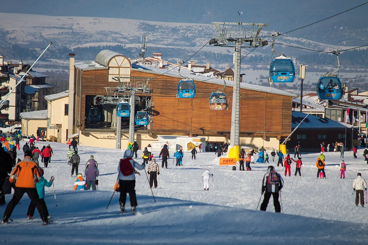
The gondola, or cabin lift, is the primary artery onto the Bansko ski map, running from the base station roughly 1.5km from Bansko town centre. Because it is the only way up for most skiers, it becomes a genuine bottleneck once the resort gets busy: arriving close to opening, or weighing up a mountain taxi or shuttle straight to Banderishka Polyana, can save a long wait in the base-station queue. Beyond the gondola, the lift network includes named chairs and drags such as Mosta, Kolarski, Banderitsa 1 and 2, Shiligarnik, Chalin Valog, Todorka, Plato, Stara kotva, Detska kotva, Panitsa B and Vlek Chalin. Tsarna Mogila also appears on resort maps, though its operational status varies through the season, so it is worth confirming locally rather than assuming it is running. If conditions turn or help is needed on the mountain, PSS mountain rescue service patrols and marker points cover all three sectors.
The gondola runs 08:30–17:00 as the main artery but creates mid-morning bottlenecks; arriving at opening or using a mountain shuttle avoids queues. Upper-sector lifts like Plato close earlier (~16:00) than the base station, forcing early decisions if tackling steeper Chalin Valog or Tomba terrain.
| Lift | Operating Hours |
|---|---|
| Gondola (cabin lift) | 08:30 - 17:00 |
| Chairlifts and drag lifts (general) | 08:45 - 16:15 |
| Banderitsa chairlift | 09:00, last ride around 16:15 |
| Plato chairlift | 09:00, last ride around 16:00 |
- Treat these as typical hours for the season and confirm the current-day schedule locally, since lifts adjust for weather and late-season conditions
Night Skiing and Checking the Bansko Webcams
Night skiing at Bansko is limited to the lower, illuminated sections of the mountain, generally around the lower Ski Road terrain rather than the upper pistes, and it is worth checking ahead since floodlit hours run shorter than daytime lift hours. Before heading up in the morning, it is also worth comparing the resort's webcams for the upper Chalin Valog terrain against those covering the lower, town-level runs; visibility and snow surface can differ noticeably between the two, particularly on cloudier days, and picking the wrong sector first can waste a clear morning. Checking both feeds takes a couple of minutes and saves relying on a printed Bansko ski map alone, which cannot show real-time cloud cover or wind.
Difficulty Reality Check: Blue, Red and Black on the Bansko Ski Map
Piste colour grading on the Bansko ski map follows the same blue, red and black system used across Europe, but the steepness within each colour is not always consistent with what visitors from bigger Alpine resorts expect. Several blue runs, particularly around the approaches into and out of Shiligarnika, hold pitches that feel closer to an easy red elsewhere, which matters for anyone building confidence sector by sector rather than following the grading blindly. Reds through Shiligarnika are a reasonably reliable step up from the beginner terrain at Banderishka Polyana, and the black pitches concentrated around Chalin Valog and the Tomba run are unambiguously advanced, with little room for a gentler line. Treat the grading as a rough guide, ski a run or two below your usual level on the first run of the day, and adjust from there once you know how the current snow is skiing.
Planning Your Bansko Ski Trip: Passes and Comparisons
Lift passes for the sectors covered by the Bansko ski map are sold at ticket windows around the base station as well as through many hotels in town, so it is worth asking at check-in whether a property sells passes directly and skips the base-station queue. Current pricing is detailed on the page covering how much Bansko lift passes cost, which is worth checking before travelling since resorts adjust rates season to season. Skiers comparing Bansko against Bulgaria's other main resort should also look at what Borovets lift passes cost and current Borovets snow conditions for a sense of how pricing and conditions stack up on a given week, and the wider rundown of other top Bulgarian resorts is a useful starting point for anyone still deciding where to base a trip. Beginners weighing up the two resorts can compare rental and lesson options directly through Bansko ski hire shops and hiring gear in Borovets before booking either one.
Common Mistakes to Avoid on the Bansko Ski Map
A handful of avoidable mistakes account for most of the frustration skiers report on the Bansko ski map, and most come down to timing rather than terrain.
- Dropping into Chalin Valog before your technique is ready for it - the upper sector's steeper pistes are not the place to discover you are out of your depth, and the lifts back out have earlier last-ride times than the base
- Missing the last lift at the Mosta connection, which can leave you working out an alternative way back to the base rather than a straightforward ride down
- Leaving the Ski Road until the very end of the day, when it becomes the busiest run on the mountain and, later in the season, can turn slushy at the lower altitude
- Assuming every blue run will feel gentle - some pitches on the map ski noticeably steeper than the blue grading suggests, so treat the colour coding as a starting point rather than a guarantee
- Skipping a check of the Tsarna Mogila lift's status before planning a route through it, given how often it sits closed compared with the rest of the network
Plato Sector: Wide Blue Runs Above Shiligarnika
The biggest omission on many first reads of the Bansko piste map is the Plato sector, the open high-mountain area above Shiligarnika. This is where the Plato 1 and Plato 2 blue runs sit, served by the Plato lift and linked back toward the Shiligarnik and Todorka areas. The terrain is broad, relatively forgiving and useful for confident beginners moving beyond Banderishka Polyana, but it is also more exposed than the lower slopes, so wind, flat light and cloud can change the experience quickly.
Plato is usually best tackled earlier in the day, when visibility is clearer and the snow surface has not been scraped thin by repeat traffic. If the webcam shows cloud sitting over the upper mountain, staying lower around Shiligarnika or Banderishka Polyana can be the better call. Also watch the last lift time: the Plato chair typically closes earlier than the gondola, so do not leave it as a late-day detour.
For trip-planning details, see Bulgaria - Wikivoyage and Bulgaria - Wikipedia.
Continue planning: Use 9 Things to Know About Ski Resorts in Bulgaria and 12 Best Tips and Activities for Apres Ski in Bansko to connect this guide with the rest of your Bulgaria itinerary.
Frequently Asked Questions
What are the three main sectors on the Bansko ski map?
The Bansko ski map splits into three real sectors: Banderishka Polyana at the base, which handles beginners and lessons; Shiligarnika in the middle, the resort's main intermediate cruising ground; and Chalin Valog at the top, around 2,560m, where the terrain steepens for more advanced skiers.
How long is the Bansko ski road?
The Ski Road's descent down to Shiligarnika runs for roughly 7.5km, making it one of the longest continuous blue-graded runs on the mountain and the standard way to end a day back toward the base.
What time does the Bansko gondola stop running?
The gondola typically runs from 08:30 to 17:00, while the resort's chairlifts and drag lifts generally close between 16:00 and 16:15 - the Plato chairlift's last ride is around 16:00 and Banderitsa's around 16:15 - so treat those times as guides and confirm the current schedule locally before planning a last run.
Is Bansko a good resort for beginners?
Yes - Banderishka Polyana at the base is built around beginner terrain and lesson access, though it is worth knowing that some blue runs elsewhere on the Bansko ski map ski steeper than the grading implies, so pacing progression through Shiligarnika before heading higher is a sensible approach.
Where can you rent skis in Bansko?
Rental counters cluster around the base area near the gondola, and the guide to Bansko ski hire shops covers current rental and lesson options if you would rather sort gear before arriving.
How far is the Bansko gondola base from the town centre?
The gondola base station sits about 1.5km from Bansko town centre, close enough to walk for most visitors staying centrally, though many opt for a short taxi ride with boots and skis in tow.