Smolyan Lakes: A Practical 2026 Guide to the Emerald Eyes of the Rhodopes
Last updated July 2026. The Smolyan Lakes — the "Emerald Eyes of the Rhodopes" — are a string of seven surviving pools climbing from Smolyan town toward Orpheus' Rocks. This guide covers which lakes are worth a stop, how to reach the scenic upper trio on foot or by chairlift, and how to fold the walk into a wider Rhodope day.
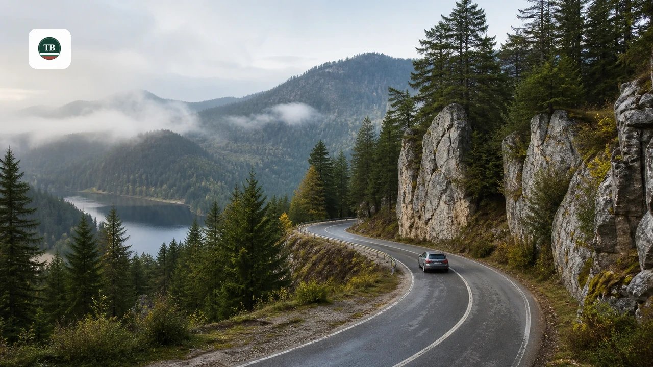
Here's an aerial view of the mountain formations and lake basin in the Rhodope plateau:
What Are the Smolyan Lakes?
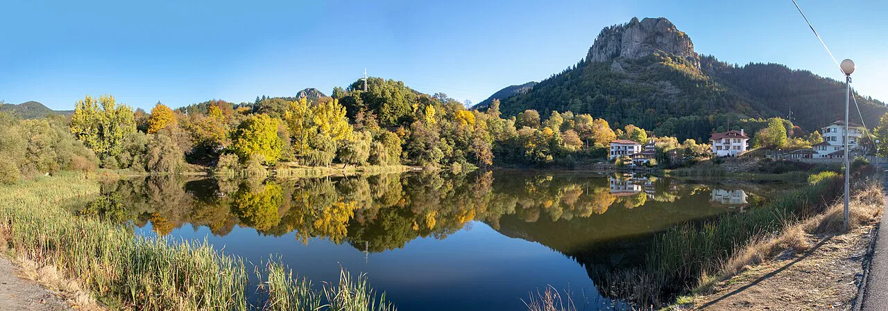
The Smolyan Lakes are a scattered group of glacial and landslide-origin lakes lying on the left slope of the Cherna River valley, directly beneath Orpheus' Rocks and Snezhanka Peak (1,926m) in the Western Rhodope Mountains. Locals sometimes call them the Emerald Eyes of the Rhodopes for the way the upper pools mirror the surrounding spruce forest. Historically there were around 20 lakes in this basin, but only seven remain as permanent bodies of water today — the rest have silted into swamps and reed beds, with a few reappearing as small seasonal pools each spring and autumn. The lakes run in a rough line from the edge of Smolyan town up to the base of the rocks, which means a visit is really two different experiences: quick roadside stops at the lower lakes, and a genuine short hike to reach the three upper lakes that most travelers come for. For town-based logistics, base planning around 10 Best Things to Do in Smolyan: Complete 2026 Guide before heading up to the lake basin.
The Upper Lakes: The Must-See Trio
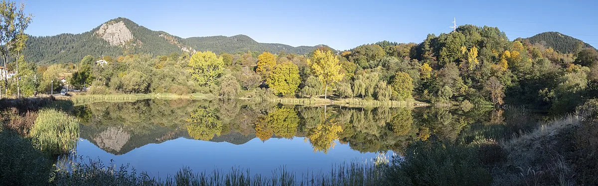
If time is short, prioritize the three uppermost lakes, reached via the road that passes Smolyanski ezera Mountain Hostel toward the chairlift. Trevistoto Lake (Grassy Lake) sits just after the hostel junction on the road to the lift; roughly 30 percent of its surface is covered by a peat layer about 1 meter thick, which grows over with grasses through the summer months, so expect a marshy, meadow-like lake rather than open water. Bistroto Lake (Clear Lake) lies only about 6 meters from Trevistoto, connected by a small creek that seeps through a boulder ridge between them — this is the most photogenic of the group, with old spruces reflected on its eastern shore, boulder 'islands' scattered on the far side, and water no more than a meter deep with a clearly visible bottom. A tourist trail toward Studenets Mountain Hostel crosses an artificial embankment at its lower end. Matnoto Lake (Muddy Lake) is the highest and deepest of the seven at 4.5 meters, reached by a steep trail starting from the road between Trevistoto and Bistroto, roughly 200 meters further up. Dense spruce forest blocks most light from reaching the water, giving it a dark, almost black surface — hence the name. Mountain Rescue Service (PSS) guidance flags a real risk of falling rocks on this stretch, so treat it as a proper short scramble, not a stroll.
The steep final approach to Matnoto Lake is loose rock with a documented falling-rock hazard flagged by Mountain Rescue Service. Sturdy, closed footwear and a careful pace are essential; treat it as a scramble, not a casual stroll.
- Trevistoto (Grassy Lake): peat-covered, meadow-like, reached first from the hostel junction
- Bistroto (Clear Lake): about 6m from Trevistoto, the most photogenic, max depth around 1m
- Matnoto (Muddy Lake): roughly 200m further up a steep, rocky trail, deepest at 4.5m
The Lower Lakes: Roadside Stops
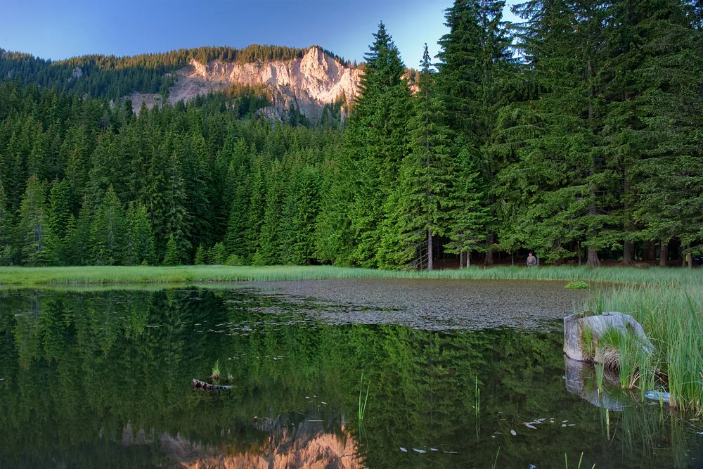
The lower lakes are strung along the road between Smolyan and Pamporovo and work well as quick stops rather than hiking destinations. Keranovia gyol Lake (also called Platenoto) sits at the edge of Smolyan on the left side of the road toward Pamporovo and Plovdiv; its lower section has been dammed, making it one of the largest lakes in the group. A smaller lake, Milusheviyat gyol, lies just above it. Along the road to Devin, below the Ezerovo housing estate, Silazha Lake has a small reed-covered island at its lower end and is a common spot for casual fishing and camping. Further along, at a wide bend in the road, Osmanoviyat gyol Lake is ringed by several smaller pools, some of which dry out completely by summer. Higher still, past the turn to Smolyanski ezera Mountain Hostel, Lagera Lake (Camp Lake) is likely the largest single lake in the basin and, like Silazha, has established camping and fishing areas nearby. None of the lower lakes require a hike — most are visible directly from a car window — which makes them worth a slow drive-by even if the upper trail isn't on the itinerary.
- Keranovia gyol / Platenoto: dammed lower section, edge of Smolyan town
- Milusheviyat gyol: small lake just above Keranovia gyol
- Silazha: reed-covered island, camping and fishing spot
- Osmanoviyat gyol: several smaller pools, some seasonal/dry in summer
- Lagera (Camp Lake): largest single lake, established camping area
How to Plan Your Visit: Logistics and Timing
Budget half a day (2 to 4 hours) for the upper trio plus a slow drive past the lower lakes; add a full day if combining the walk with Orpheus' Rocks. The most common starting point for the hiking portion is Smolyanski ezera Mountain Hostel, from where the trail continues up past Trevistoto and Bistroto to the Matnoto turnoff. There are two practical ways to reach that starting point: driving directly from Smolyan along the Pamporovo road (the lower lakes are visible along the way, so this route doubles as sightseeing), or taking the chairlift from the Studenets area of Pamporovo, which lands closer to the upper lakes and avoids the steepest section of approach road on foot. Drivers gain flexibility to stop at each roadside lake; the chairlift trades that flexibility for a shorter walking distance to the scenic trio. Either way, sturdy, closed footwear is non-negotiable once the trail leaves the road, since the surface toward Matnoto is loose rock rather than packed path.
Spring and autumn deliver higher water levels and fuller scenery; summer offers firmer trail conditions for the climb but risks smaller pools drying out completely. Choose timing based on whether visual impact or trail stability is the priority.
Costs and Practical Information
The Smolyan Lakes are a protected natural landmark with no entry fee, and access is currently open year-round with no gate or ticket booth reported at the site. Parking is informal near the chairlift base and near Smolyanski ezera Mountain Hostel, so arrive earlier in the day during summer weekends when capacity is tightest. For maps, trail conditions, and up-to-date advice, the Tourist Information Center in Smolyan is the best first stop before heading up to the lakes.
| Resource | Details |
|---|---|
| Tourist Information Center – Smolyan | 8:30–12:00 and 12:30–17:00 on weekdays (confirm current hours on smolyan.bg), bul. Bulgaria 5, tel. +359 301 62530 |
| Smolyan Municipality | 12 Bulgaria Blvd, tel. +359 301 67666, smolyan.bg |
| Entry fee | Free — natural landmark, no ticket booth |
| Parking | Informal lots near the chairlift base and Smolyanski ezera Mountain Hostel |
Nearby Sights to Combine with the Lakes
The upper lakes sit close enough to several other Rhodope landmarks that it's worth building a longer loop around them. From the lake basin, a marked trail continues toward Orpheus' Rocks, the dramatic rock formation the lakes sit just below, adding a scenic detour before doubling back to the hostel or chairlift. The chairlift itself can also be used purely for the view, carrying visitors up toward Snezhanka Peak's panoramic outlook without requiring the full lake-trail walk. For a broader regional plan, pair the lakes with 10 Best Things to Do in Smolyan: Complete 2026 Guide for town logistics, or extend outward to Pamporovo for chairlift and resort options via Things to Do in Pamporovo, Bulgaria: Complete 2026 Guide. Travelers building a multi-day Rhodope route can add Uhlovitsa Cave Guide: the Rhodopes' Underground Icefall and the Wonderful Bridges to the same itinerary, use Shiroka Laka Village Travel Guide: Bulgaria's Architectural Reserve for cultural context and traditional architecture nearby, or continue east toward the Rozhen Observatory: Visiting Bulgaria's Star Mountain. For a full regional overview, see things to do in the Rhodope Mountains.
Mistakes to Avoid and Local Tips
The single biggest planning mistake is expecting all seven lakes to look like postcard photos — several of the lower lakes and former lake sites are now marshland or seasonal pools rather than open water, so calibrate expectations before setting out, especially in late summer when smaller pools can dry up. On the Matnoto trail, stay alert for falling rocks on the steep final stretch, a hazard the Mountain Rescue Service (PSS) flags specifically for this section; sturdy footwear with good grip matters more here than anywhere else on the route. Timing also affects the experience differently depending on the goal: spring and autumn generally show higher water levels and a fuller, more scenic set of lakes, while summer offers firmer, drier trail conditions for the climb to Matnoto but a higher chance of the smaller seasonal pools being reduced to damp ground. Weekday visits, or an early start on weekends, help avoid parking congestion near the hostel and chairlift base during peak summer months.
- Expect marshland at several former lake sites, not open water everywhere
- Watch for falling rocks on the steep Matnoto Lake trail
- Visit spring or autumn for higher water levels; summer for firmer trail footing
- Wear sturdy, closed footwear for the rocky stretch above the road
Virtual Map and Orientation
Picture the route as a straight line climbing from Smolyan town toward Snezhanka Peak. At the bottom, Keranovia gyol and Milusheviyat gyol sit right at the edge of town on the Pamporovo road. Moving up the Devin road, Silazha appears near the Ezerovo estate, followed by Osmanoviyat gyol at the next bend. Continuing past the turn for Smolyanski ezera Mountain Hostel, Lagera Lake opens up as the largest single body of water in the group. From there, the road climbs toward the chairlift, passing Trevistoto and then Bistroto, which sit a short walk apart, with the short, steep spur to Matnoto branching off roughly 200 meters beyond. Orpheus' Rocks and the Snezhanka ridge form the visual backdrop above the entire upper cluster, making them a natural landmark to navigate by even without a paper map.
See our guide to 10 Best Things to Do in Smolyan: Complete 2026 Guide for the broader city overview.
Continue planning: Use 10 Best Things to Do in Smolyan and Rozhen Observatory: Visiting Bulgaria's Star Mountain to connect this guide with the rest of your Bulgaria itinerary.
Frequently Asked Questions
How many Smolyan Lakes are there today?
Historically there were around 20 lakes in the basin, but only 7 remain as permanent bodies of water in 2026, since the rest have become swamps or seasonal pools that only reappear briefly in spring and autumn.
Which Smolyan Lake should you visit first if time is limited?
Prioritize the upper trio — Trevistoto, Bistroto, and Matnoto — reached via Smolyanski ezera Mountain Hostel. Bistroto is generally considered the most photogenic, and it and Trevistoto sit a short walk apart, making both easy to see together, while Matnoto requires a steeper, rockier 200-meter climb beyond them.
Is there an entry fee for the Smolyan Lakes?
No. The Smolyan Lakes are a protected natural landmark with free access and no ticket booth as of 2026.
How should you get to the Smolyan Lakes: drive or take the chairlift?
Both work. Driving from Smolyan along the Pamporovo road lets you stop at each of the lower roadside lakes along the way, while the chairlift from the Studenets area of Pamporovo lands closer to the upper lakes and shortens the walking approach to the scenic trio.
How much time should you plan for a visit to the Smolyan Lakes?
Allow a half-day, roughly 2 to 4 hours, to cover the upper lake trail and a drive-by of the lower lakes. Add extra time, closer to a full day, if combining the visit with the nearby hike to Orpheus' Rocks.
Is the trail to Matnoto Lake safe?
It requires care rather than technical skill. The final approach to Matnoto Lake is a steep, rocky trail with a documented risk of falling rocks flagged by the Mountain Rescue Service (PSS), so sturdy, closed footwear and a slower pace are recommended on that stretch.