Ropotamo River and Beglik Tash Near Primorsko: A Full Day-Trip Guide
Last updated August 2026, this guide covers Ropotamo River and Beglik Tash near Primorsko as one paired day trip. The boat station and the sanctuary sit about 5 to 7 kilometers (3 to 4 miles) from Primorsko's town center, on the same forest road. For the wider list of nearby stops, see this guide to 12 Best Things to Do in Primorsko, Bulgaria (2026 Guide).
Ropotamo River and Beglik Tash Near Primorsko: Planning the Combined Visit
Both landmarks sit south of Primorsko on the same stretch of coast. Treating them as one outing saves a second drive out the next day. Beglik Tash rewards an early start, before the rock terrace heats up and the light turns harsh. Ropotamo's boat trip works better once the late-morning haze over the river clears. Primorsko sits about 50 kilometers (31 miles) from Burgas and roughly 450 kilometers (280 miles) from Sofia, according to Bulgaria's official tourism portal. Most travelers are already based on this stretch of coast, rather than driving in for a single day. Bring a printed or downloaded map, since cell coverage can drop inside the forest sections of the reserve.
The Ropotamo Nature Reserve and Its Wetland Protections
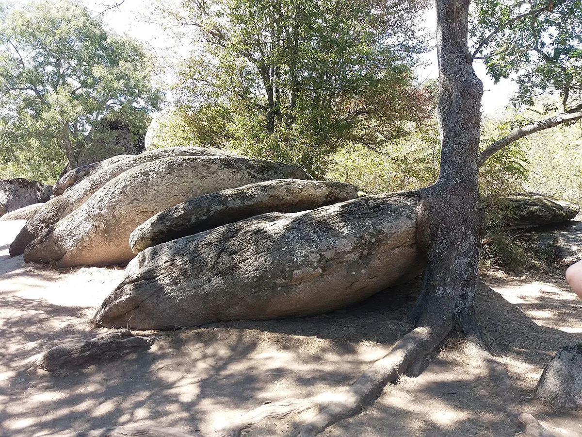
Ropotamo Nature Reserve forms part of a larger protected wetland known as the Ropotamo Ramsar site. That designation covers the river basin, the Arkutino-area marshlands, dense forest, and a range of coastal rock formations. Two related protected zones sit close to the main reserve, one of them named Beglik Tash-Ropotamo. Another covers rock formations, fjord-like inlets, and a seal cave near Cape Maslen Nos. This whole area sits within the broader Thracian heritage of Bulgaria's southern Black Sea coast and the Strandzha region.
Beglik Tash: The Thracian Sun Sanctuary
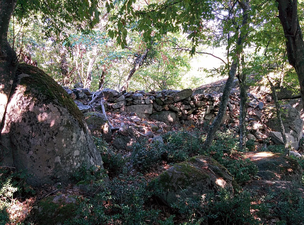
The sanctuary sits at the summit of Beglik Tash peak, about 128 meters (420 feet) above sea level. Its ritual terrace covers roughly 6 decares, close to 1.5 acres, centered on a stone circle about 56 meters (184 feet) across. Thracians built the site in the middle of the second millennium BC as a sun-cult space, and used it until the early fourth century AD, per the country's tourism authority. Look for the flat rock locals call the marriage bed and the narrow passage known as the path of ordeal, both on the standard walking route. Photographers get the strongest light within an hour of sunrise or before sunset, when low sun rakes across the stone surfaces. Little tree cover shades the terrace, so carry water and sun protection even for a short visit.
- Elevation: about 128 meters (420 feet) above sea level
- Site area: roughly 6 decares, close to 1.5 acres
- Ritual circle diameter: about 56 meters (184 feet)
- Timeline: built in the middle of the second millennium BC, used until the early fourth century AD
Ropotamo River: The Boat Trip vs. the Hiking Route
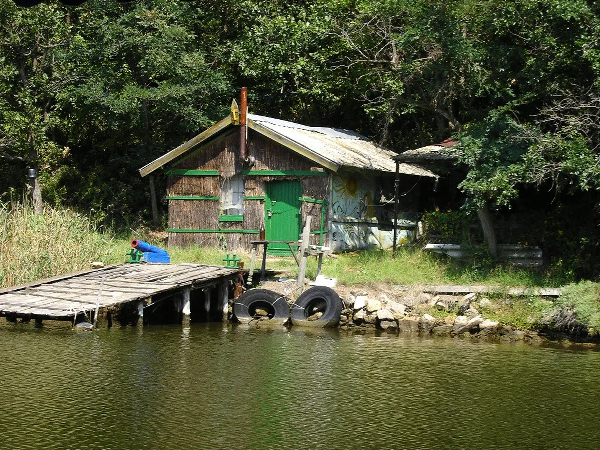
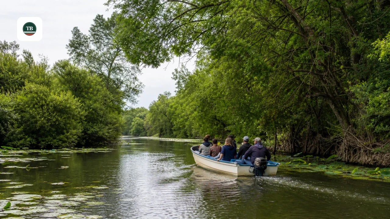
Boats leave from a station on the main Sozopol-Primorsko road, right where it crosses the Ropotamo River. Short guided trips run past banks lined with European white water lilies and trees that lean low over the water. Cypress-like trees along this stretch give the river an enclosed, still feel that's unusual for the Bulgarian coast. Hikers can reach the river mouth on foot instead, following the eco-path that starts near Beglik Tash. Watch for freshwater turtles on fallen branches, deer moving through the tree line, and the reserve's rare wetland birds. The boat's slow pace and shaded seating make it one of the reserve's easier activities for younger kids. For beach time afterward, see this guide to family-friendly beaches in Bulgaria.
| Method | Starting Point | What You Get | Best For |
|---|---|---|---|
| Boat Trip | Boat station on the Sozopol-Primorsko road | River mouth views, water lilies, a distant look at the Lion's Head | Relaxed sightseeing and families |
| Hiking Route | Eco-path from Beglik Tash | Close-up river mouth and a pass within about 300 m (984 ft) of the Lion's Head | Active travelers and birdwatchers |
The Lion's Head Rock Formation and Valchanovo Kale Fortress
Lavskata Glava, known in English as the Lion's Head, is a syenite formation dated at 65 to 70 million years old. It rises about 80 meters (262 feet) above the Ropotamo River, right where the Sozopol-Primorsko road runs alongside the water. Drivers can spot it without stopping, which is why it's one of the most photographed formations in the reserve. Hikers get a closer view: one reserve trail passes within about 300 meters (984 feet) of the rock. Ruins nearby mark a settlement first fortified in the early Iron Age and later known as Valchanovo Kale, a fortress used into the 19th century.
Hikers following the eco-path can get within 300 meters (984 feet) of the Lion's Head formation, whereas the boat trip offers only a distant view; hikers and boat riders see the same landmark from fundamentally different vantage points.
Getting There: The Perla Road From Primorsko
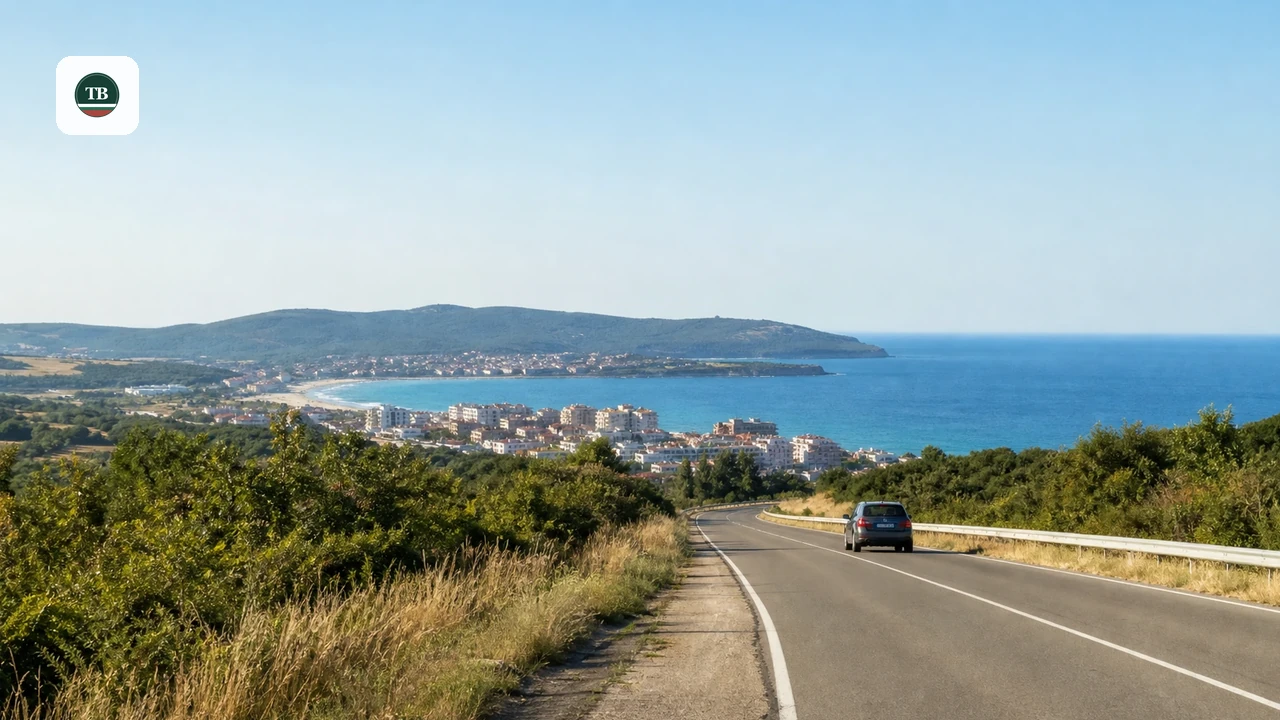
Reach both sites from Primorsko by car, by bicycle, or on foot. This route leaves town past North Beach and the Perla Residence, both detailed in this guide to Primorsko's beaches. Past the Perla Residence, the road stays paved through forest until a signed junction. Look for a sign reading Бегликташ, Beglik Tash in Cyrillic, beside a barrier marking the turnoff. The full stretch from town runs 5 to 7 kilometers (3 to 4 miles), an easy bike ride or a longer walk in summer heat.
A Suggested Day Plan: Timing Beglik Tash and the Ropotamo Together
A single day works well if you start early and build in a midday break. Both sites charge a modest fee, payable in Bulgarian lev at the gate or boat station. Rates shift through the season, so confirm the current figure on-site instead of relying on an old number. As a rule, the boat trip costs more than the standalone Beglik Tash entry, since it covers fuel and a guide. For a broader look at seasonal weather and crowd patterns, see this guide to when to visit Primorsko.
- 09:00 - Arrive at Beglik Tash while temperatures stay low and the sanctuary is quiet for photos.
- 11:00 - Hike toward Bay St. Paraskeva, or continue on to the Ropotamo river mouth on the eco-path.
- 13:00 - Break for lunch or a swim before the afternoon heat peaks.
- 14:00 - Join the Ropotamo boat trip from the station on the Sozopol-Primorsko road, once the water is calmest.
Best Season and Weather for a Visit
Primorsko has a temperate-continental climate softened by the Black Sea, with mild winters and long summers. July averages about 23 to 24°C (73 to 75°F), which is warm enough to make an early Beglik Tash start worth planning around. Spring and early summer bring cooler hiking weather and lower crowds at both the sanctuary and the boat station. Peak August draws the heaviest crowds and the tightest parking at the Beglik Tash barrier. Early autumn keeps most of the summer warmth while trimming the crowds, a reasonable trade-off for a first visit.
Side Trips: Cape Maslen Nos and Bay St. Paraskeva
Hikers with extra time can extend the Beglik Tash trail toward Cape Maslen Nos, once an ancient harbor and navigation marker. Its coastline now shows rock formations locals compare to fjords, plus waters known for fishing. A separate trail from Beglik Tash reaches Bay St. Paraskeva, a secluded cove that sheltered pirates in the Middle Ages. Neither stop has direct road access, so both reward hikers more than casual walkers. Check current trail conditions locally before attempting either extension, since forest paths can wash out after heavy rain. For other coves and beaches along this coastline, see this list of Black Sea beaches in Bulgaria.
Trail Distances and Difficulty at a Glance
Difficulty ratings below reflect our editorial assessment, since the reserve doesn't post official trail grades. Distances are approximate where the source material doesn't give an exact figure.
| Trail | Connects | Difficulty | Highlights |
|---|---|---|---|
| Access road to Beglik Tash | Primorsko town to the sanctuary barrier | Easy | Mostly paved the whole way |
| Eco-path to the Ropotamo mouth | Beglik Tash to the river mouth | Moderate | River views, water lilies, birdlife |
| Trail near the Lion's Head | Reserve trail network to the rock formation | Moderate | Passes within about 300 m (984 ft) of the formation |
| Trail to Cape Maslen Nos | Beglik Tash toward the coast | Moderate to hard | Fjord-like rocks, an ancient harbor site |
| Trail to Bay St. Paraskeva | Beglik Tash to the cove | Moderate | Secluded beach, pirate-era history |
What to Pack and Mistakes to Avoid
Flip-flops are the most common misstep; the terrain around both sites is rocky and uneven, and sneakers hold up far better. Skipping insect repellent is the second mistake, since mosquito activity picks up near the river in the early evening. Parking at the Beglik Tash barrier fills up fast during peak August. Arrive by mid-morning, or plan to walk the last stretch if the lot is full. Confirm opening hours for both sites before setting out, since schedules can shift with the season.
Bring at least 1 liter of water per person and insect repellent—the riverside trails pass through wetland areas where rare birds and other wildlife keep you outside even as evening mosquito activity peaks.
- Closed-toe sneakers or hiking shoes, not flip-flops, for the rocky trail terrain
- At least 1 liter of water per person, since Beglik Tash has little shade
- Insect repellent for mosquito activity near the river
- A hat and sunscreen, especially for a 09:00 start
- Cash in Bulgarian lev for entrance fees and the boat trip
Frequently Asked Questions
Can you visit Beglik Tash and the Ropotamo River in one day from Primorsko?
Yes, most visitors combine both in a single day trip from Primorsko. Start at Beglik Tash by mid-morning, before the rock terrace gets hot. Save the Ropotamo boat trip for early afternoon, when the water and light are calmer.
How do you get from Primorsko to Beglik Tash without a car?
The access road covers about 5 to 7 kilometers (3 to 4 miles) from the town center. Cyclists can ride the full route, since most of it stays paved. Walkers should budget extra time for summer heat and carry water for the return trip.
What will you actually see on the Ropotamo River boat trip?
Boats depart from the station on the Sozopol-Primorsko road, where it crosses the river. The route passes banks lined with European white water lilies and low cypress-like trees. Riders also get a distant view of the Lion's Head rock formation from the water.
What should you pack for a visit to Beglik Tash and the Ropotamo reserve?
Pack closed-toe shoes, since the terrain around both sites is rocky and uneven. Bring at least a liter of water per person, plus insect repellent for the riverside trails. A hat and sunscreen matter too, since Beglik Tash has little shade.
Where should you base yourself to visit both sites easily?
Primorsko itself works well, since both sites sit on the same access road out of town. If you're comparing other options along the coast, see this roundup of Black Sea beach resorts. Either way, plan for a short drive or bike ride rather than a long transfer.
What's the best time of year to visit Beglik Tash and the Ropotamo River?
Late spring and early autumn offer the most comfortable hiking weather. July and August bring the warmest temperatures, around 23 to 24°C (73 to 75°F), plus the biggest crowds. If you're visiting in peak summer, aim for the 09:00 Beglik Tash start outlined above.
Do Beglik Tash and the Ropotamo boat trip charge an entrance fee?
Yes, both charge a modest fee collected on-site. Beglik Tash charges at the entrance barrier, while the boat trip is priced separately at its station on the Sozopol-Primorsko road. Confirm the current amount locally, since neither site publishes a fixed year-round rate.