Vratsata Gorge Hiking Trails in Vrachanski Balkan Nature Park
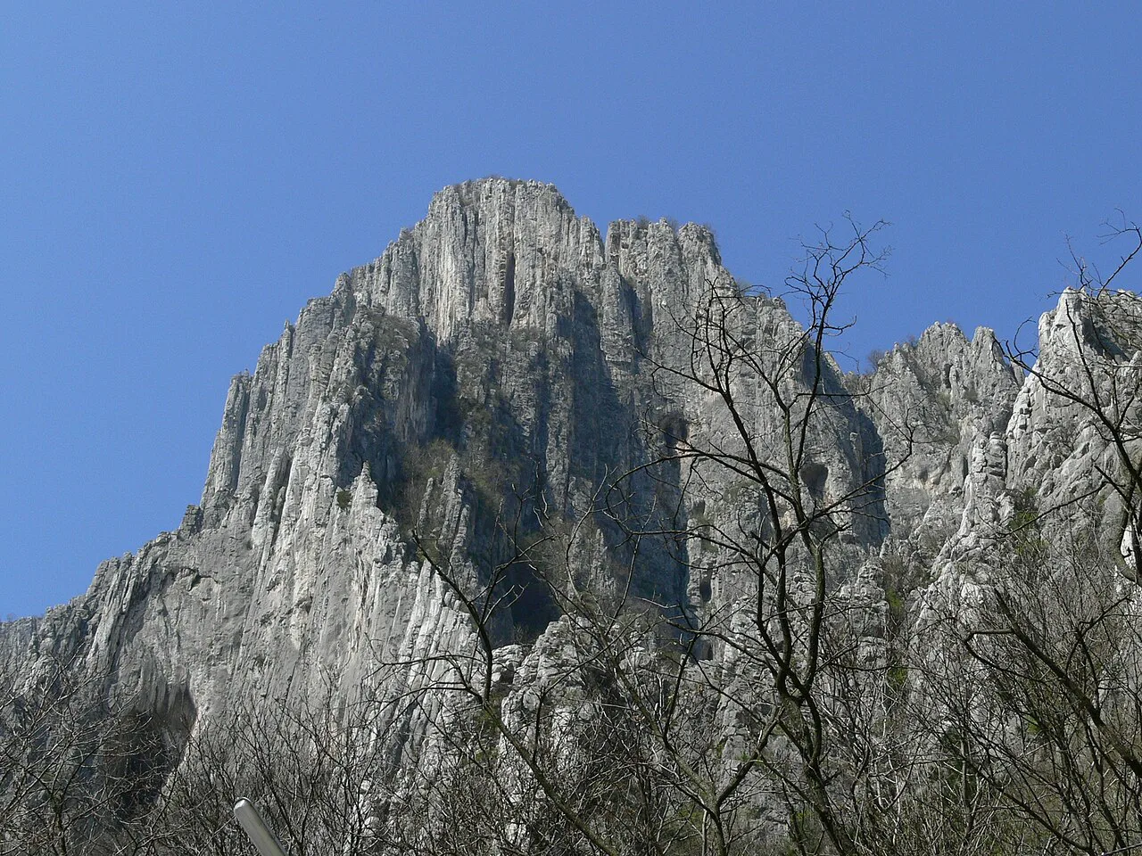
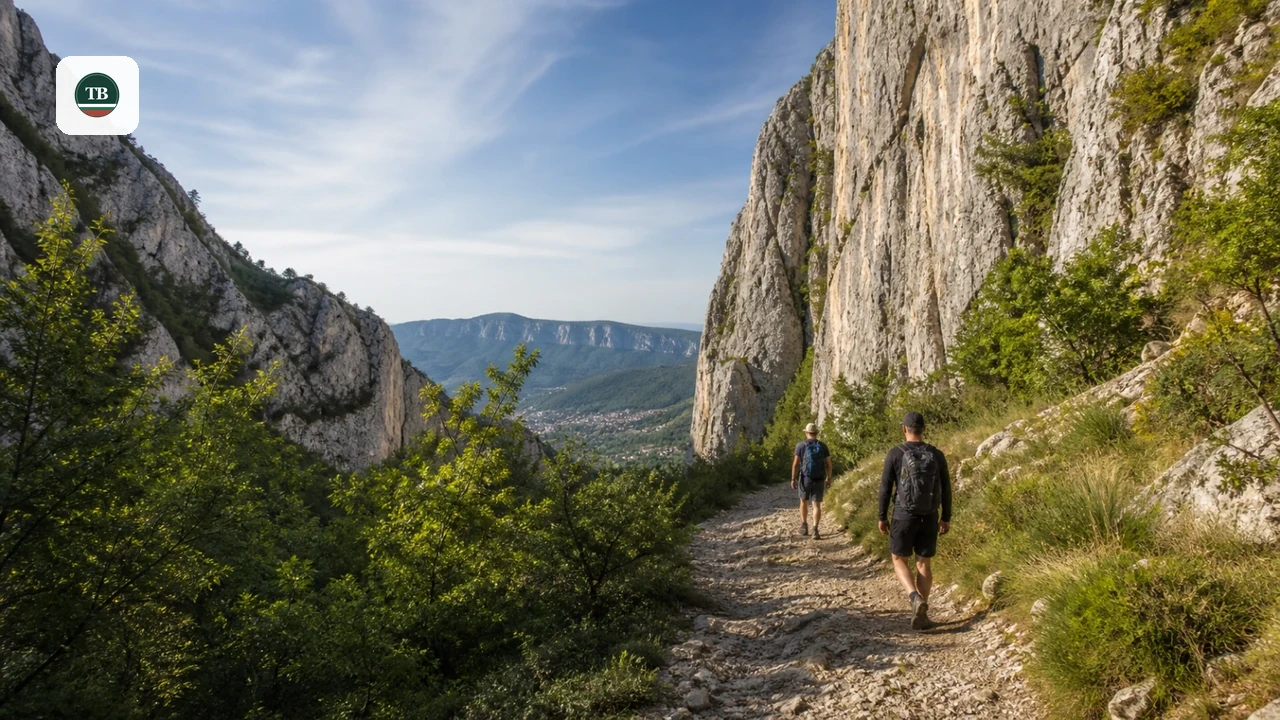
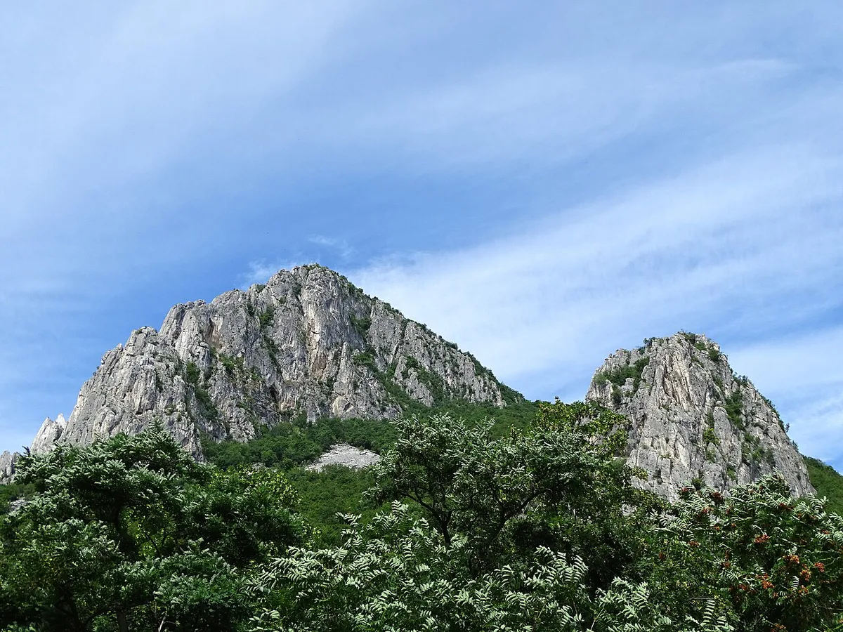
Last updated August 2026. Vratsata Gorge hiking trails wind beneath limestone walls that rise more than 400 meters above the Leva River, among the tallest vertical rock faces on the Balkan Peninsula. This gorge sits at the entrance to Vrachanski Balkan Nature Park, a karst landscape of caves, ridges, and seasonal waterfalls just outside Vratsa town. Three main routes — Borov Kamak, Vrachanska Skaklya, and Okolchitsa — cover everything from a forested waterfall walk to a sure-footed ridge climb.
Vratsata Gorge Hiking Trails at a Glance
Vrachanski Balkan Nature Park is the second-largest nature park in Bulgaria, protecting a limestone karst landscape around Vratsa. It covers a much larger area than Vratsata Gorge alone, which forms just the park's dramatic entrance corridor. That gorge is the park's signature landmark, declared a natural landmark in 1964. Central Wall, Eastern Massif, and Zgorigrad Massif together carry more than 400 traced climbing routes, including named lines such as Mirrors, Second Congress, Winkel, and Dog's Tooth. Remains of the medieval Vratitsa fortress sit inside the gorge itself, so a walk through it doubles as a short history stop. Pick a route from the table below, then check logistics and trail notes further down this guide. For a full rundown of the town's landmarks and museums, pair this guide with the Vratsa things-to-do guide.
| Trail | Distance & Time | Difficulty | Best For |
|---|---|---|---|
| Borov Kamak Eco-Trail | ~9 km loop, about 3.5 hours | Moderate | Waterfall views with some scrambling on the ladders |
| Vrachanska Skaklya Waterfall | ~1.5 km one-way, about 1 hour climb | Moderate, steep | A short, high-payoff hike in spring |
| Okolchitsa Peak (Gara Lakatnik route) | 4.3-8.4 km loop, about 2-3 hours | Hard | History-focused hikers comfortable with exposure |
Getting From Sofia to Vratsa: Car, Train, and Bus
Vratsa is a regional city in Northwestern Bulgaria, about 111 kilometers north of Sofia. Drivers can choose the scenic route through the Iskar Gorge, which passes Lakatnik and adds a stop at Zhitolyub Waterfall. A faster option runs via the A2 motorway instead. Either way, expect roughly two hours behind the wheel. Bus and train service both connect Sofia to Vratsa directly, detailed below.
- By car: about 2 hours from Sofia via the Iskar Gorge (scenic route past Lakatnik) or the faster A2 motorway
- By bus: hourly departures from Sofia's Central Bus Station, journey time about 2 hours 10 minutes
- By train: about 2 hours 20 minutes from Sofia, with a required transfer at Mezdra Station
- From Vratsa town center: Vratsata Pass and the gorge entrance are a walkable 1 km along the Leva River
- From Zgorigrad trailheads: no direct rail link, so plan on a taxi or local bus from Vratsa
Borov Kamak Eco-Trail: The Ladders Behind the Waterfall
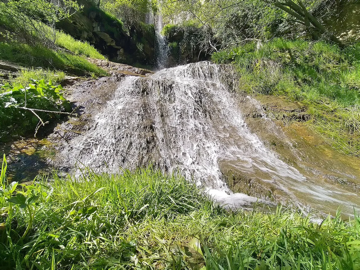
Borov Kamak draws the most attention among Vrachanski Balkan's eco-trails, per Komoot's community route data, and its trailhead sits on the outskirts of Zgorigrad village. Wooden bridges and ladders carry the path behind the waterfall itself, which is the trail's signature feature. Recent hiker reports flag the ladders as slippery when wet, so save this route for dry conditions if possible.
Borov Kamak takes 3.5 hours and features wooden ladders that turn slippery when wet, making waterproof boots with aggressive tread an essential piece of gear for this route.
- Distance: about 9 km for the full Borov Kamak Shelter loop from Zgorigrad
- Time: roughly 3.5 hours at a moderate pace, or about 1.5 hours one-way to the waterfall alone
- Elevation gain: around 630 meters across the full loop, per Komoot's route data
- Difficulty: rated Moderate, though the wooden ladder sections demand steady footing and are not ideal for severe vertigo
- Shorter option: a 3.9 km out-and-back loop reaches the waterfall in under two hours
Vrachanska Skaklya Waterfall and the Dry-Season Reality Check
Skaklya drops 141 meters down a limestone ridge, making it the tallest intermittent waterfall in Bulgaria. Its trailhead sits about 1.5 km south of town, near the area above Vratsa's hospital, and the climb to the base takes about an hour on a steep path. Fed by a small seasonal stream, Skaklya only runs at full flow during snowmelt or right after heavy rain. Skaklya sits inside the 1,467-hectare Vrachanski Karst nature reserve, managed by the regional environmental inspectorate (RIOSV-Vratsa).
- Spring (April-May): the most reliable window, with snowmelt keeping the falls active most days
- After heavy rain: a temporary surge worth chasing if the forecast lines up with a free afternoon
- Summer and autumn: commonly dry or reduced to a trickle, based on multiple recent hiker reports
Vratitsa Fortress and the Karst Trail to Ledenika Cave
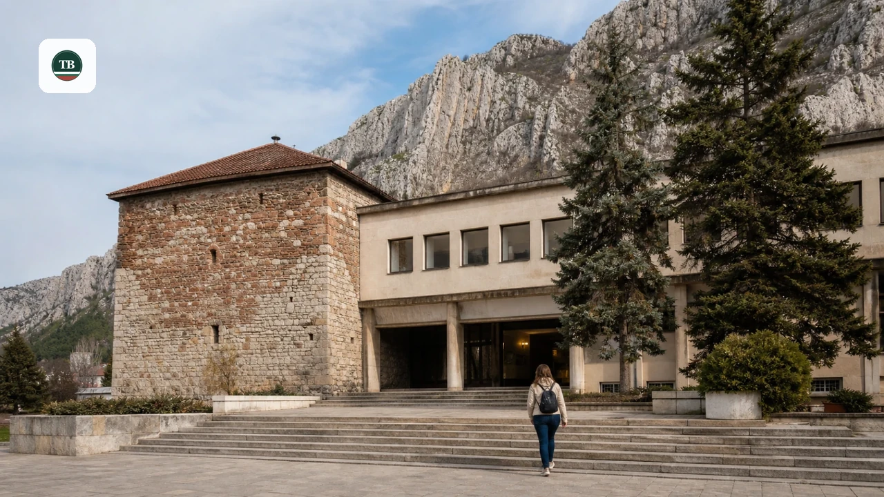
Vratitsa Heritage Trail begins at Vratsata Pass and follows the ruins of a fortress first built during the Roman period. Byzantine rulers and the Second Bulgarian Kingdom later held the site. By the 13th century it had grown into a medieval town, and Ottoman rule took over in the 14th century. Walking the ridge above the Central Wall pairs history with some of the gorge's best views.
Okolchitsa Peak: The Hard Climb or the Easy Drive
Okolchitsa Peak marks the site where national hero Hristo Botev died in battle, and a monument at the summit honors him and the soldiers who fell alongside him. Hikers can reach the top two ways: a marked trail from Gara Lakatnik or a direct drive to the summit. Both reach the same panoramic ridge walk near the monument.
- Hard route: Gara Lakatnik to Okolchitsa Monument, about 4.3 km and 1 hour 50 minutes, rated Hard on the Swiss Alpine Club scale
- Longer loop: Vratsa Cross Viewpoint combined with Okolchitsa Monument, about 8.4 km and roughly 2 hours 45 minutes
- Easy option: drive to the summit parking and walk the ridge for the same panoramic view without the elevation gain
En Route Stops: Zhitolyub Waterfall, St. Ivan Pusti Monastery, and God's Bridge
A few stops beyond the main trails reward the extra detour, especially if driving between Sofia and Vratsa.
- Zhitolyub Waterfall: visible from the road on the outskirts of Lakatnik in the Iskar Gorge, fed by a karst spring that emerges from Temnata Dupka Cave through a narrow siphon
- St. Ivan Pusti Monastery: about 12 km northwest of Vratsa, with a small waterfall below it and preserved frescoes in a cave above the monastery grounds
- God's Bridge (Bozhi Most): a karst rock passage about 15 km north of Vratsa near the villages of Lilyache and Chiren, reachable by a short drive from Chiren or a 40-minute walk from Lilyache
Planning Tips, Gear, and Trail Safety
Limestone terrain holds heat and offers little shade on exposed ridges, so carry more water than a similar-length forest hike would need.
- Skip sneakers on Borov Kamak's wooden ladders; wear boots with real tread, since the wood turns slippery when wet
- Do not plan a summer trip around a full-flow Skaklya; check recent trail reports first or aim for spring instead
- Treat sure-footedness as a real requirement, not a formality, on any route rated Moderate or Hard in this guide
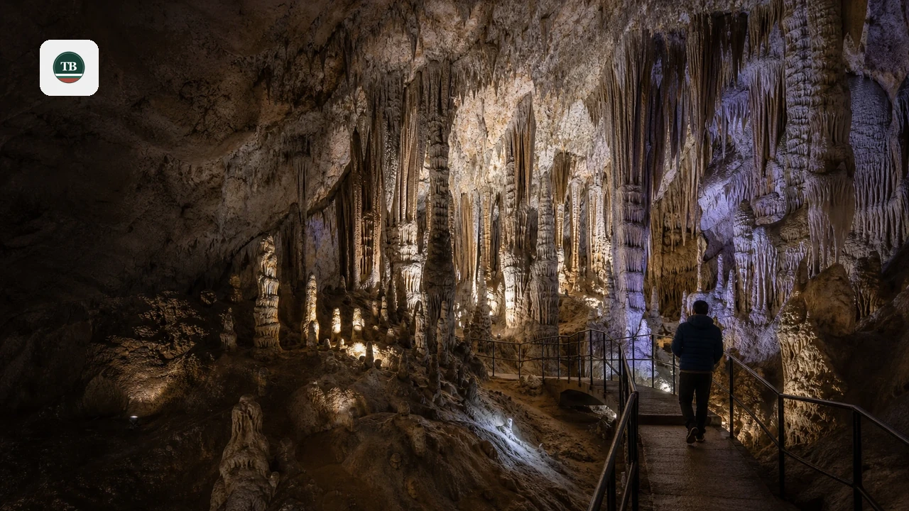
- Carry your own water on the Ledenika karst trail and the Borov Kamak eco-trail, since neither has a guaranteed source
- Expect basic rest space at trailside shelters such as Borov Kamak Shelter, but do not count on them for gear or supplies
Where to Stay and Eat Near Vratsata Gorge
Vratsa town works as the main base, with the Chaika Hotel Complex among the options closest to the gorge itself. Zgorigrad offers a village feel and sits right at the Borov Kamak trailhead, which suits an early start. Guesthouses in town, such as Villa Teodora in the Medkovets neighborhood, are known for home-style Bulgarian cooking alongside simple rooms. Local menus generally lean into the same hearty Balkan diet found across Northwestern Bulgaria, useful fuel after a day on the trails. Rooms can be hard to find during local events in Vratsa, so booking ahead matters more than usual on those weekends.
For those targeting Skaklya's 141 meters, book accommodation in spring (April-May) when snowmelt reliably feeds the cascade rather than summer when it typically dries to a trickle.
Vrachanski Balkan vs Rila and Pirin: Where This Fits in a Bulgaria Trip
Vrachanski Balkan's limestone karst reads differently than the granite alpine terrain of Rila and Pirin further south. Rila holds Musala Peak, the tallest summit in the Balkans at 2,925 meters, along with the glacial Seven Rila Lakes. Pirin is a UNESCO-listed park with more than 180 glacial lakes and jagged peaks reaching 2,914 meters at Mount Vihren. Vratsata Gorge trades those glacial lakes for cave systems, sheer rock walls, and a lower-elevation trail network that stays accessible for more of the year.
Make a Lakatnik Stop on the Sofia–Vratsa Journey
Build a Lakatnik stop into the scenic Sofia–Vratsa route if you want an Iskar Gorge break before reaching the main hiking base.
By car, use the Iskar Gorge road rather than the motorway and allow time to stop near Lakatnik. Zhitolyub Waterfall sits on the settlement’s outskirts. Its water comes from a karst spring connected to Temnata Dupka Cave through a narrow siphon. This is a short roadside stop, not a replacement for a full Vratsata hike.
By train, choose a Sofia–Mezdra service that calls at Lakatnik. Continue to Mezdra afterward, then change for Vratsa. Check the timetable closely and leave a buffer for the onward connection.
- Best for: drivers on the scenic route and train travelers with flexible schedules.
- Pair it with: Vratsata Gorge later that day or the following morning.
- Skip it if: you need the fastest Sofia–Vratsa transfer, since motorway routing is quicker.
For trip-planning details, see Vratsa.
Frequently Asked Questions
Is Vratsata Gorge hiking suitable for beginners?
Some sections work for beginners, but most named routes call for sure footing and sturdy shoes. The Vratitsa Heritage Trail near Vratsata Pass is the gentlest option, while Borov Kamak and Okolchitsa involve steeper, more technical stretches.
When does Vrachanska Skaklya Waterfall actually flow?
Skaklya runs fullest in spring, from April through May, when snowmelt feeds the stream above it. It also surges briefly after heavy rain, but commonly dries up or slows to a trickle by mid-summer and into autumn.
How do you get from Sofia to the Vratsata Gorge trailheads?
Driving takes about 2 hours via the Iskar Gorge or the A2 motorway. Trains take about 2 hours 20 minutes with a transfer at Mezdra. Buses run hourly from Sofia's Central Bus Station, in roughly 2 hours 10 minutes.
Are the Borov Kamak ladders safe in wet weather?
The wooden ladders and bridges behind the waterfall become slippery when rained on, according to recent hiker reports. Sturdy, grippy footwear matters more here than on most of the park's other trails.
Can you combine Vratsata Gorge with a visit to Ledenika Cave?
Yes, Ledenika Cave sits about 16 km west of Vratsa and pairs naturally with the karst trail beside it. Many visitors treat the cave and its 3.2 km loop as a half-day add-on to a gorge hike.
How hard is the Okolchitsa Peak hike?
Gara Lakatnik's route to Okolchitsa Monument rates Hard on the Swiss Alpine Club scale, despite covering only about 4.3 km, because of exposure and required sure-footedness. Drivers who want the same ridge view without the climb can reach the summit by road instead.
What should you pack for a Vratsata Gorge hiking trip?
Bring boots with real grip rather than sneakers, since limestone and wet wood both get slippery. Carry more water than usual, since shade is limited on exposed ridges and reliable refill points are scarce along most routes.