Vratsa Hiking and Ledenika Cave Guide
Last updated July 2026: Vratsa is a practical base for hiking beneath the Vrachanski Balkan's karst cliffs and visiting Ledenika Cave. About 112-116 km (70-72 miles) north of Sofia, it can work as a long day trip, though an overnight gives more time for the Vratsata Gorge and mountain trails. This guide compares the main routes, cave access, transport, and the seasonal conditions needed to see Skaklya Waterfall with water.
Why Visit Vratsa, Bulgaria
Vratsa is the largest city in northwestern Bulgaria and the administrative center of Vratsa Province. It sits at the foot of the Vrachanski Balkan, on the banks of the Leva River. The city is about 112-116 km (70-72 miles) north of Sofia and roughly 40 km (25 miles) southeast of Montana. Its 2022 population was recorded at 49,569 in the city and 60,361 across the wider urban area. Vratsa combines dramatic karst cliffs, an ice cave, and one of Bulgaria's largest Thracian silver finds inside a single, walkable city. Travelers building a wider loop can pair the stop with the top Bulgaria destinations covered elsewhere in this series.
The Vratsata Gorge and the Vrachanski Balkan
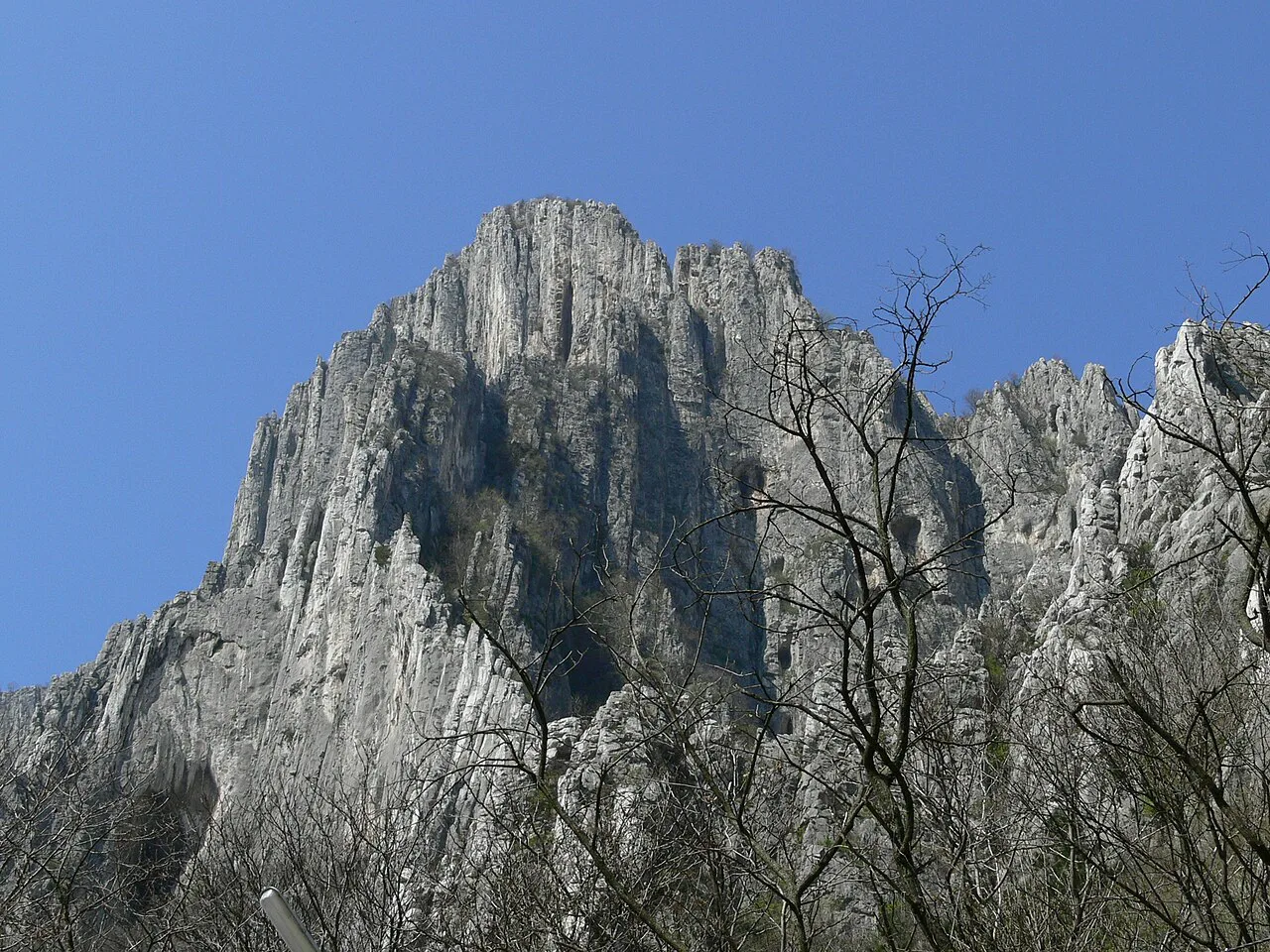
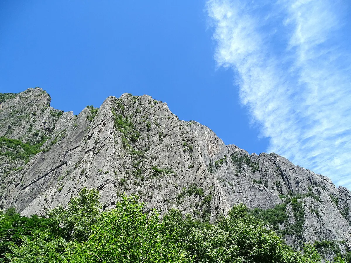
The Vratsata Gorge holds the highest vertical cliffs on the Balkan Peninsula, rising directly above the city's southern edge. Rock climbers use established routes on the limestone walls. Photographers gather near the pass for wide views of the gorge at sunrise and sunset. The gorge also gives Vratsa its name. It comes from the Slavic word vrata, meaning gate, plus a diminutive suffix meaning little gate. The pass marks the natural boundary between the city and the wider Vrachanski Balkan nature park.
Ledenika Cave and the Symphony Hall
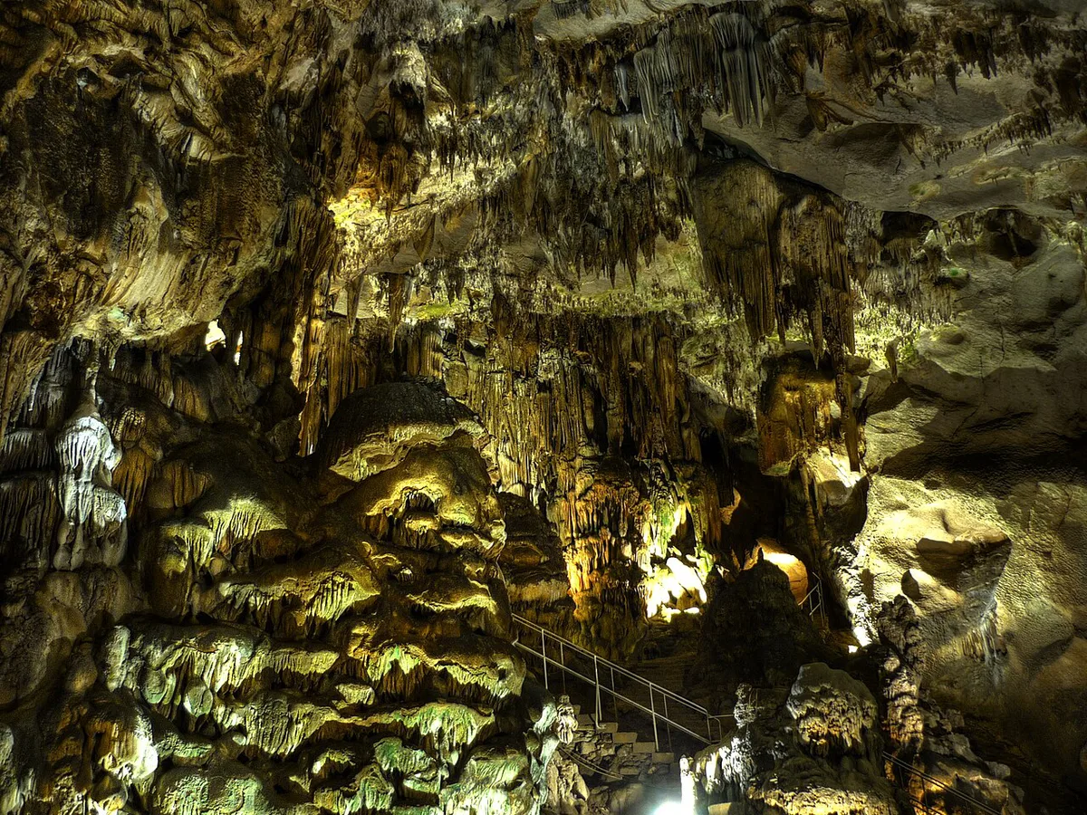
Ledenika Cave, whose name translates to Ice Cave, sits inside the Vratsa State Forestry, reached via the tourist tram from the city center. Guided tours pass through chambers of stalactites and stalagmites, including one chamber known as the Symphony hall for its acoustics. Cave temperature stays close to 8°C (46°F) year-round, so bring a layer even in summer. Tour intervals shift by season, so check the current schedule before making the trip out to Zgorigrad.
Regional History Museum and the Rogozen Treasure
Vratsa's Regional History Museum holds the Rogozen Treasure, the largest Thracian silver treasure ever found in Bulgaria. The collection includes engraved vessels used in Thracian ceremonial life. Some pieces occasionally travel to exhibitions elsewhere, so confirm the current display list with the museum before building a visit solely around the treasure. The museum also tends to close earlier in the afternoon than Vratsa's outdoor sights, a scheduling gap that catches same-day visitors off guard.
Skaklya Waterfall: The Waterfall Gamble
Skaklya is the highest intermittent waterfall in Bulgaria, dropping over a Jurassic limestone cliff on the edge of the Vrachanski Balkan. It only runs after heavy rain or during spring snowmelt. Treat the hike as a scenic cliff walk rather than a guaranteed waterfall in late summer or autumn. Spring visits, or trips timed just after a rainy spell, give the best odds of seeing water at all. Arriving in August expecting a waterfall is one of the most common planning mistakes travelers make in Vratsa.
Hristo Botev Square and the Climb to Vestitelya Hut
Hristo Botev Square is the city's main gathering point, named for the Bulgarian revolutionary poet. It hosts the rally-dawn commemoration each June 1, part of the annual Botev Days events. Above the square, a stairway of 463 steps climbs to Vestitelya Hut, a mountain refuge with a panoramic view over the city and the gorge. In our editorial assessment, the climb is a moderate-to-strenuous effort, better suited to visitors comfortable with sustained stair climbing than to a casual stroll.
Vratsa Hiking Trails Compared
Vratsa's hiking trails range from a short cave loop to technical rock climbing. The table below compares difficulty, starting point, and what each route is best for.
Vestitelya Hut climb delivers guaranteed panoramic city views via 463 moderate-to-strenuous steps, whereas the moderate Skaklya Waterfall hike is a seasonal gamble—water appears only after heavy rain or spring snowmelt. Choose Vestitelya for assured vistas or Skaklya for spring visits when flow is likely.
| Trail | Difficulty | Starting Point | Best For |
|---|---|---|---|
| Vestitelya Hut stairway | Moderate to strenuous | Near Hristo Botev Square | Panoramic city views |
| Skaklya Waterfall hike | Moderate | Trailhead near Vratsata | Waterfall photography (spring/after rain) |
| Ledenika Cave and Zgorigrad | Easy | Tourist tram from the center | Cave tour with a short walk |
| Kobilini Steni | Moderate | Trailhead outside the center | Forest and meadow views |
| Vratsata Gorge climbing routes | Strenuous (technical) | Vratsata Pass | Rock climbing and photography |
Day Trip or Overnight? Planning Your Time in Vratsa
A single day covers Vratsa's core sights comfortably. That includes the gorge viewpoint, the history museum, and either Ledenika Cave or the Vestitelya Hut climb. Hikers who want to cover more of the Vrachanski Balkan trail network should plan at least two days. That extra day allows time for Skaklya Waterfall, Kobilini Steni, and one outlying day trip without rushing between them.
Vratsa lies 1.5 to 2 hours north of Sofia, making it feasible as a one-day trip for core sights like the gorge and museum. Hikers targeting the Vrachanski Balkan trail network should plan at least two days to cover Skaklya Waterfall, Kobilini Steni, and the Vestitelya Hut climb without rushing between sites.
Getting To and Around Vratsa
Vratsa is about 112-116 km (70-72 miles) north of Sofia. Driving takes roughly 1.5 to 2 hours by car. A rental car is the fastest option and the easiest way to reach outlying sights like Skaklya Waterfall. Trains and intercity buses also run from Sofia's stations to Vratsa. Both typically cost less than a rental car for a solo traveler. Schedules run less frequently than car travel allows, so check current timetables before booking. Inside the city, most central sights sit within walking distance of each other. A tourist tram connects the center to Ledenika Park. It passes through Vratsata and Zgorigrad, the starting point for several local hikes. Check the current tram schedule locally before planning a hike around it.
Best Time to Visit Vratsa
Spring gives the best odds of seeing Skaklya Waterfall running and brings green cover to the gorge trails. Summer adds Botev Days, held from May 27 to June 2. The main rally-dawn takes place at Hristo Botev Square on June 1. A national worship ceremony follows at Mount Okolchitsa on June 2. Autumn brings foliage color to the Vrachanski Balkan slopes, though the waterfall is usually dry by then. Winters run cold under Vratsa's humid continental climate. The average annual temperature is near 11°C (52°F). Mountain trails and the Vestitelya Hut stairway can turn icy in winter, so check conditions locally before a cold-season climb.
Costs, Tickets, and Where to Stay
Vratsa's paid sights are modest by regional standards, and lodging splits mainly between the center and the mountain foothills.
- Regional History Museum: entry costs less than a typical restaurant meal in town; check current rates before visiting.
- Ledenika Cave: guided-tour entry is also priced below a full meal out, though hours and pricing shift by season.
- City-center stays: closest to Hristo Botev Square, the history museum, and the Vratsata viewpoint.
- Foothill or Zgorigrad stays: closest to the Ledenika Cave trailhead and the start of several hikes.
What to Eat in Vratsa
Vratsa's taverns serve lyutika, a roasted pepper salad blended with garlic and sunflower or olive oil, as a starter across the region. Kartofena lyutika swaps in roasted potato for a milder, creamier version of the same dish. Local banitsa recipes fold in leeks and hot peppers rather than the plain cheese filling common in Sofia. A thick bean stew, often flavored with smoked meat, rounds out a typical Vratsa meal. Small family-run taverns tend to make lyutika fresh in-house, while some tourist-facing restaurants serve a jarred or pre-made version. Ask before ordering if an authentic version matters.
Day Trips from Vratsa: Cherepish Monastery, God's Bridge, and Ritlite
Several natural and historic sites sit within a short drive of Vratsa, making the city a good base for a second day. Drivers extending the loop east toward Bulgaria's north-central towns can continue on to Troyan's mountain passes or the historic quarter of Lovech. Travelers focused on ancient history can pair Vratsa with Hisarya's Roman ruins further south. A longer Bulgaria itinerary sometimes adds central towns such as Tryavna's old town, though that route adds significant driving time from Vratsa.
- Cherepish Monastery: set on the Iskar River gorge, reachable as a scenic half-day trip.
- God's Bridge (Bozhiyat Most): a natural rock arch near the village of Lilyache; signage is sparse compared with Ledenika, so confirm directions locally or with a downloaded map before setting out.
- Ritlite: a set of vertical rock plates near the village of Lyutibrod.
- Kobilini Steni: a shaded forest trail opening onto meadow viewpoints.
Common Mistakes to Avoid
Most Vratsa planning problems come down to timing rather than distance.
- Underestimating mountain weather: conditions on the Vrachanski Balkan trails can shift quickly, even when the city center is mild.
- Expecting Skaklya Waterfall to run in August: it is intermittent and often dry by late summer.
- Ignoring the museum's shorter hours: outdoor sights often stay open later than the Regional History Museum.
- Skipping the tram schedule check: the tourist tram to Ledenika Park does not run continuously, so confirm times before heading out.
Vratsa in Context: Name, History, and Botev Days
Vratsa's name comes from the Slavic word for gate, a reference to the Vratsata Pass above the city. The city carries the motto 'a city like the Balkan, ancient and young,' reflecting its layered history. Vratsa holds sister-city partnerships with towns abroad, a marker of its role as a regional hub in northwestern Bulgaria. Hristo Botev's legacy runs through the city's main square and its annual commemorations. The Botev Days events, held from May 27 to June 2, culminate in the June 1 rally-dawn and the June 2 national worship at Mount Okolchitsa.
How to Find God’s Bridge near Lilyache
God’s Bridge, or Bozhiyat Most, lies in the karst countryside north of Lilyache, about 15 kilometers from Vratsa. It is not visible from the main village road, and local signs can be easy to miss.
Search for “Божия мост” as well as “Bozhiyat Most” in your navigation app. Download the map before leaving Vratsa because mobile coverage may weaken outside the village. The final approach follows an unpaved track and then a short walking path. Road conditions can deteriorate after rain, so drivers with low-clearance cars should park before the roughest section.
- Carry water because there are no dependable visitor facilities at the rock formation.
- Wear shoes with grip because the limestone and streambed can become slippery.
- Allow extra time to locate the path rather than treating the stop as a quick roadside viewpoint.
The natural bridge spans a seasonal stream within the Chiren-Lilyache karst area. Pair it with Vratsa’s Regional History Museum or Vratsata Gorge for a practical half-day excursion.
Further reading: Bulgaria on Wikivoyage · Bulgaria on Wikipedia
Continue planning: Use 18 Best Places to Visit in Bulgaria and Hisarya Roman Ruins and Spa Day Trip Guide to connect this guide with the rest of your Bulgaria itinerary.
Frequently Asked Questions
How far is Vratsa from Sofia?
Vratsa sits about 112-116 km (70-72 miles) north of Sofia. Driving takes roughly 1.5 to 2 hours. Trains and intercity buses also connect the two cities, though schedules run less frequently than car travel, so check current timetables before booking.
Does Skaklya Waterfall always have water?
No. Skaklya is Bulgaria's highest intermittent waterfall, and it only runs after heavy rain or spring snowmelt. It is often dry by late summer and autumn, so plan a spring visit, or one right after rain, for the best odds of seeing water.
How cold is Ledenika Cave?
Ledenika Cave stays close to 8°C (46°F) year-round. Bring a layer even during a summer visit, and check the current tour schedule before heading out on the tourist tram to Zgorigrad.
Should visitors plan a day trip or stay overnight in Vratsa?
A single day covers the core sights: the gorge viewpoint, the history museum, and either Ledenika Cave or the Vestitelya Hut climb. Hikers who want to cover more of the Vrachanski Balkan trail network, including Skaklya Waterfall, should plan at least two days.
What is lyutika?
Lyutika is a roasted pepper salad served across Vratsa's taverns, usually blended with garlic and oil. A potato-based version, kartofena lyutika, offers a milder alternative. Small family-run taverns tend to make it fresh, while some tourist-facing spots serve a jarred version.